MapQuest Integrates Flock Surveillance Camera Tracking Into Its Mapping Platform

Introduction to the New Mapping Feature
Mapping and navigation platforms have traditionally focused on optimizing routes, calculating travel times, and helping drivers bypass traffic bottlenecks. However, MapQuest is taking a distinctly different approach with a recent platform update that surfaces surveillance infrastructure directly within its interface. By integrating data on Flock Safety automated license plate reader (ALPR) cameras, the service is shedding light on the physical footprint of neighborhood monitoring systems.
This development bridges the gap between everyday navigation utilities and civic awareness, giving everyday drivers unprecedented visibility into where automated optical surveillance is active along their daily routes. As digital mapping tools evolve beyond basic pathfinding, the inclusion of privacy-adjacent data points signals a shift in how utility software interacts with urban infrastructure and public data transparency.
Understanding Flock Safety and ALPR Technology
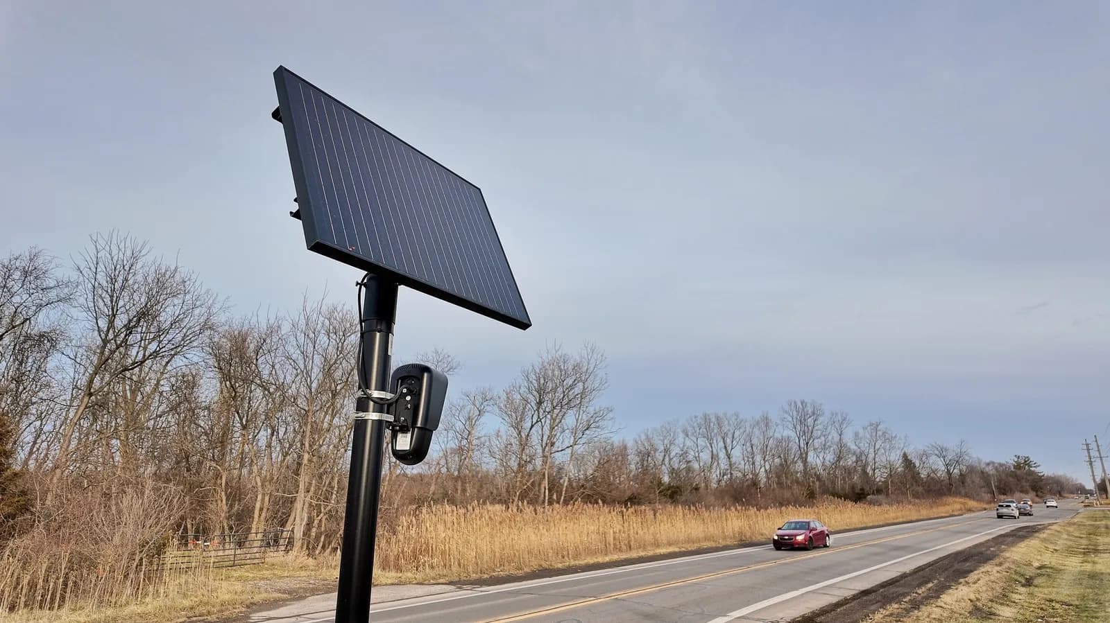
To appreciate the implications of MapQuest's new integration, it is helpful to examine the technology underlying Flock Safety's network. Flock cameras are specialized, solar-powered optical devices typically mounted on utility poles and neighborhood entrances. Unlike traditional dashcams or municipal traffic lights, these systems are engineered specifically to capture detailed imagery of passing vehicles, focusing primarily on license plates, make, model, color, and even secondary vehicle characteristics like bumper stickers or roof racks.
The collected data is then processed using machine learning algorithms and matched against law enforcement databases in real-time. While proponents emphasize the utility of these systems in recovering stolen vehicles and aiding investigations into property crimes or violent offenses, privacy advocates and civil liberties organizations have frequently raised concerns about the scale of passive data collection affecting ordinary citizens who are not suspected of any wrongdoing.
The Intersection of Navigation and Public Surveillance
Historically, discovering the physical presence of surveillance hardware required keen observation or access to municipal public records. By embedding this information directly into a consumer-facing mapping application, MapQuest is democratizing access to infrastructure data that was previously fragmented or obscure. Users can now view known camera placements right alongside turn-by-turn directions, transforming a routine map check into a passive audit of neighborhood security environments.
This integration reflects a broader consumer demand for transparency in the digital age. Just as drivers appreciate knowing where speed cameras, red-light traps, or construction delays are located, having awareness of persistent optical tracking nodes changes how people interact with public spaces. It turns a blind spot into a visible data layer, prompting discussions about consent, urban observation, and the right to travel without continuous digital logging.
Implications for Everyday Commuters and Drivers
For the average commuter, the immediate impact of seeing Flock cameras on a map is informational and psychological. Drivers value predictability and control over their environment. Knowing precisely which intersections or subdivision entrances are monitored by automated plate readers allows individuals to make informed choices about their travel habits, reinforcing a sense of personal awareness in increasingly instrumented cities.
At the same time, this visibility highlights the sheer density of modern monitoring infrastructure. Many motorists are surprised to learn how many cameras blanket suburban neighborhoods and commercial corridors. By exposing this invisible grid on a familiar mapping canvas, MapQuest is helping everyday people visualize the physical footprint of data-driven policing and private security networks that have rapidly expanded over recent years.
Developer and Data Integration Perspectives
From a technical standpoint, adding surveillance tracking to a mapping application underscores the growing importance of geospatial data pipelining. Integrating third-party data layers requires robust API architectures, reliable coordinate mapping, and continuous updates to reflect hardware installations, removals, or relocations. Developers working in the geospatial and civic tech domains will likely view this move as a precursor to more complex, multi-layered mapping applications that blend transit routes with municipal sensor data.
Furthermore, maintaining the accuracy of these camera registries presents an engineering and administrative challenge. Because neighborhood surveillance networks are decentralized and constantly shifting, platforms must rely on crowdsourcing, open records requests, or partnerships with transparency groups to keep their databases current. This introduces interesting questions about data provenance, verification pipelines, and the liability of mapping providers hosting infrastructure metadata.
Broader Industry Trends and Future Outlook
MapQuest's decision to display surveillance cameras could trigger a ripple effect across the broader mapping and navigation industry. Major competitors like Google Maps, Apple Maps, and Waze have long incorporated crowd-sourced speed traps and hazard warnings, but integrating permanent civic and private surveillance infrastructure represents a distinct evolutionary step. If users respond favorably to this added visibility, other navigation platforms may feel pressured to follow suit to satisfy growing consumer interest in digital privacy and urban transparency.
As cities become increasingly smart and sensor-laden, the boundary between navigation software and civic auditing tools will continue to blur. Developers and product strategists will need to navigate the delicate balance between utility, user privacy, and regulatory compliance. Whether this feature becomes a standard expectation for modern mapping apps or remains a specialized differentiator will depend heavily on user adoption and evolving legal frameworks surrounding public data.
Closing Thoughts
The integration of Flock camera locations into MapQuest marks a fascinating convergence of everyday navigation technology and modern surveillance awareness. By making invisible infrastructure visible to the average driver, the platform is empowering users with greater context about the environments they traverse daily. As software continues to map every facet of the physical world, incorporating infrastructure transparency will likely become an increasingly critical component of how we understand our digital and physical surroundings.
Source: engadget.com